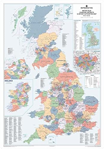


UK Wall Map Laminated Large Map - Counties, District and Unitary Authority Boundaries | Local District Councils, Roadmap, Postcode Areas, London Boroughs, Population Figures by Amazon.co.uk
Price last update: 13/06/2025
Product information
- Colour:Laminated
- Brand:Map Marketing
- Map type:City Tour
Related products to UK Wall Map Laminated Large Map - Counties, District and Unitary Authority Boundaries | Local District Councils, Roadmap, Postcode Areas, London Boroughs, Population Figures:


Other products from Maps:


UK Wall Map Laminated Large Map - Counties, District and Unitary Authority Boundaries | Local District Councils, Roadmap, Postcode Areas, London Boroughs, Population Figures by Amazon.co.uk